Our Services
For any inquiries or to discuss how we can support your projects, please reach out. We are committed to delivering top-notch solutions tailored to your needs.

Topographic Mapping
A topographic survey is a detailed map of a land area that shows its natural and man-made features, typically used to plan new construction, grading, drainage, and utility design.

As-Built
An as-built survey is a record of a construction project after it's completed. It could be an airport runway or a buried power line.

Construction Staking
Construction surveying, is the process of establishing reference points and markers for construction projects. It's used to ensure that a construction project is built in the correct location and elevation.

Control Networks
A control network is a spatial framework established using Global Positioning System (GPS) technology to provide accurate position data across a designated area. This system typically comprises a series of physical reference points, known as control stations, which are strategically distributed throughout the project area.
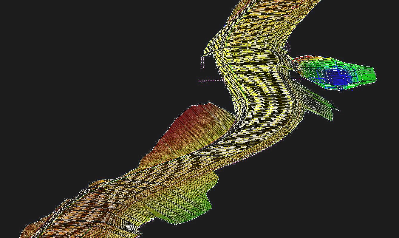
3D Machine Control Models
A "3D machine control model" is a digital, three-dimensional representation of a construction site used in machine control systems to precisely guide heavy machinery like excavators, graders, and bulldozers during earthmoving tasks, allowing them to automatically adjust their blade or bucket position to achieve the desired grade based on the model's design.

Boundary
A boundary survey is a critical process that defines the exact location of a property’s boundaries, determining the legal limits of ownership. This type of survey involves a thorough examination of historical deeds and survey plats, as well as the physical inspection of the property.